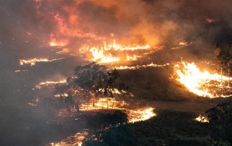
 The number of days with a Forest Fire Danger Index Rating of 'Very High' or above could triple in some parts of Victoria by the end of the century.
The number of high-risk bushfire days could triple in some parts of Victoria by the end of the century, according to new climate research by CFA and international research bodies.
The research, published this month in the International Journal of Wildland Fire, found that under different emissions scenarios both mean and extreme fire danger are expected to increase in Victoria.
Statewide, research modelling indicates a 10 to 20 per cent increase in extreme Forest Fire Danger Index, with the greatest change projected in the north-west region.
However, the greatest relative change in the number of ‘Very High’ days per year will be in central and eastern parts of the state where there is a projected doubling and tripling, respectively in the number of ‘Very High’ days. Report co-author, CFA Manager Research and Development Dr Sarah Harris, said scenarios used in the research show increased temperature, caused by human-induced climate change, to be the main driver of heightened fire danger.
“Changes in temperature, humidity and rainfall during spring and early summer mean the fire season will continue to start earlier and run longer. As a flow-on effect, springtime opportunities for prescribed burning could reduce,” she said.
CFA Chief Officer Jason Heffernan said he was proud of CFA’s robust research program, which he said brought further understanding of the impacts of climate change in the context of firefighting.
“As firefighters, we see the effects of these longer and more severe fire seasons and it’s important that we turn our minds towards what firefighting looks like in the not-too-distant future,” he said.
“CFA is undertaking work to identify challenges brought on by climate change and increased fire risk, and ways to solve them through adaptation and mitigation.
“CFA also proudly works to reduce our own greenhouse emissions, through initiatives such as increasing our use of rooftop solar and the number of hybrid vehicles in the fleet.”
CFA Manager Research and Development Sarah Harris co-authored the research with researchers Scott Clark (School of Earth, Atmosphere and Environment, Monash University), Timothy Brown (Desert Research Institute in Nevada, USA), Graham Mills (Monash University) and John T. Abatzoglou (School of Engineering, University of California).
The research was funded through Safer Together, a Victorian approach to reducing the risks of bushfire through fire and land agencies such as CFA, Forest Fire Management Victoria and Parks Victoria working together with communities, combining in-depth local knowledge with the latest science and technology to reduce bushfire risk on both public and private land.
Forest Fire Management Victoria Chief Fire Officer Chris Hardman said partnerships with community and agencies such as CFA and FRV help ensure we are unified in emergency preparedness and response to keep the community and environment safe.
“We know that Victoria is one of the most bushfire prone areas in the world. Climate change is increasing the risk bushfires pose to our communities, our critical infrastructure and our environment,” he said.
“That’s why our strategic approach to managing bushfire risk is based on the best evidence available, such as this research.
“We have a 365-day approach to fuel management, more mechanical treatment and increasing capacity to contain bushfires at first attack. We are also prioritising empowering Traditional Owners to lead self-determined cultural fire practices on country.”
Table of projected future fire weather for five locations across Victoria
| Mean number of ‘Very High’ fire risk days (FFDI>25) per year |
Historical period (1973-2016) | Project period 2085-2100 based on multi-model mean of high emission scenario |
Walpeup (representing far North West Victoria) | 60 | 100 |
Wangaratta (representing the North East) | 17.5 | 39 |
Bairnsdale (representing South East Victoria) | 3.5 | 8 |
Mortlake (representing the South West) | 12 | 17.5 |
Melbourne (representing central Victoria) | 12.5 | 22.5 |